Port of London Rivermap

Interactive rivermap

UK networks map

Terminals map

World connections atlas
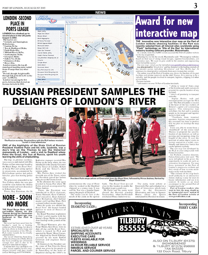
It’s 2003 and Google maps is not even a twinkle in the eye and Flash is a new and exciting technology, not yet subsumed into the Adobe ecosystem. Working with branding agency Futura, I create a suite of interactive maps using Flash and hooked up to the Port of London’s terminals database. Uniquely for the time users are able to zoom, pan and scroll around the maps which are linked together and allow operators to plan end-to-end journeys for freight around the world.
The site won a prestigious Macromedia ‘Site of the Day’ award in July of that year.